Not far from Blowing Rock, North Carolina, exists a small gravel lot atop the mountainside of a twisty mountain road. Here, one can access a massively long trail that theoretically takes you to the coast of North Carolina. Although the journey is long, it is a passable route (mostly before Hurricane Helene) that takes east to the southern NC coast or west to the Great Smoky Mountains National Park. This trail is called the Mountain-to-Sea Trail (learn more here).
I decided to check the trail out for myself. I had no intention to travel the entire route (5 protein bars weren’t enough), but I did want to check out a portion of the mountainous section of the trail. So, my close friend and I began the journey from the Charlotte metro to Blowing Rock, North Carolina, on a cold December in 2024. We set out on a Saturday morning bound for the gravel lot. I recently found the lot by traveling a back road out of Blowing Rock a few weeks back. I never even thought it was the Mountain-to-Sea Trail until I saw the initials “MST”. From there, it clicked in my head.
Honestly, the drive was quite relaxing compared to the normal circumstances. If you live in Charlotte and travel up to Blowing Rock/Boone, you’ll know that 321 is the normal way to go. However, the GPS has me follow I-77 to I-40. They eventually put me on a two-lane up to Lenior. It was a picture-perfect combination of rolling hills and farmland. Much more relaxing than an interstate.
Arriving at Blowing Rock, there were traces of snow and ice, but frigid high 20s were still in the air. This was only the second time I’ve been up to Blowing Rock since Hurricane Helene. The town was very lively given the weather. It looks as if much has gotten back to normal. However, it’s a slightly different story out on the roads and trails. As for Boone, I couldn’t say anything about my own experiences. Boone, North Carolina, is built around a small creek, I believe. So flooding was certainly worse there.
Mountain-to-Sea Trail: Hike to Hebron Falls
After passing through Blowing Rock, we made the short journey to that same gravel lot. We passed the Blue Ridge Parkway, which was closed due to ice. It’s a shame because some of my favorite views of the mountains are along that road. But it’s completely understandable. The lot was still in its same condition; we were the only ones there. Off in the distance, I saw beautiful glistening tops of snowy mountains. The snow remained in heavy concentration at the top of the mountains. This presented a beautiful contrast against the non-snowy mountain landscape.
Once we became settled, we began our hike, heading for Hebron Falls and whatever else came our way. I didn’t plan much except for the necessary supplies and the general direction. I was determined to see what came our way on the hike. It brings a sense of adventure to my journeys. But I’m always excited to report back here. However, I did know that a waterfall called Hebron Falls was in our direction. That’s about what I know, but I was excited to get there.
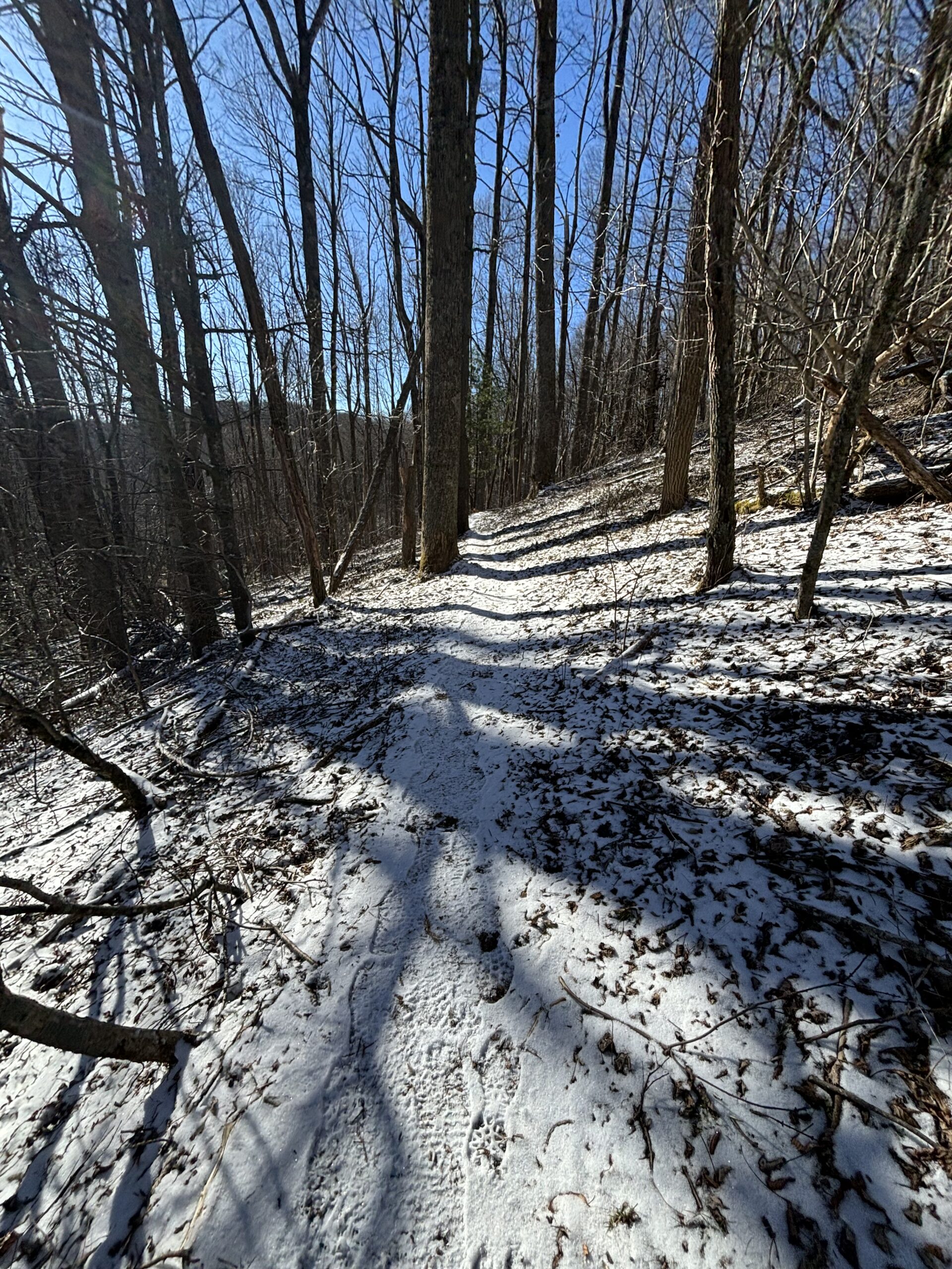
Along the trek, we followed narrow passes along steep embankments and quickly descending downhill treks (that would haunt us later). We did pass a wave of destruction from Hurricane Helene. An area of mudslide housed countless numbers of trees, and a painstaking path was cut through them via chainsaw. The only evidence of water there was a trickle across the trail. As you can tell, the flooding was massive during Hurricane Helene here. I’m very grateful to those who spent the time to return this place to normal.

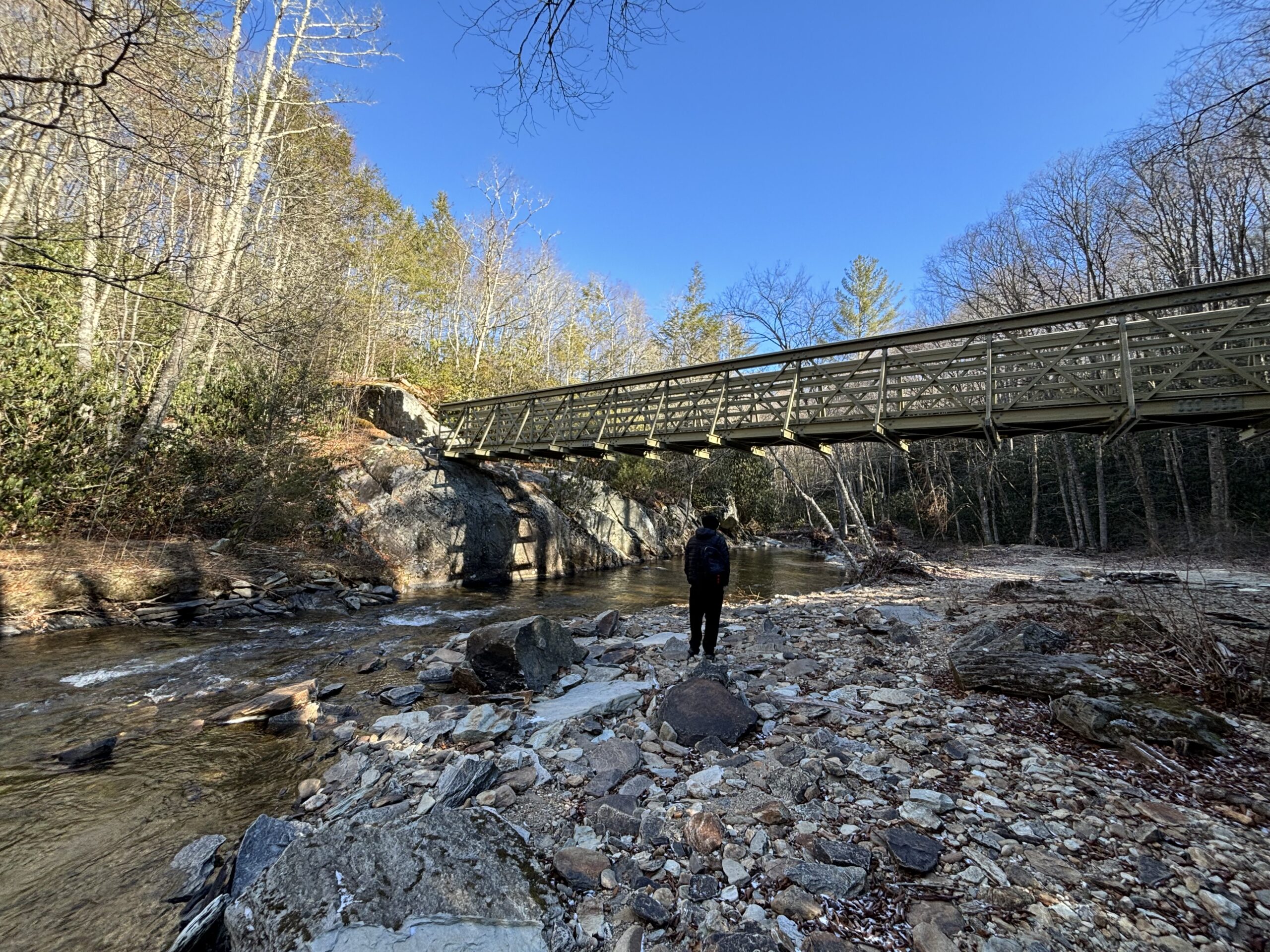
After about 1.5 miles, we encountered a campsite and the Boone Fork waterway. The Mountain-to-Sea Trail met up here with the Boone Fork Trail. This intersection features a decent-sized footbridge across the Boone Fork and a natural swimming area for the summertime. My friend and I did not find much other than ice. The spot would be a spectacular place to camp for the night. I’m a bit envious of those who do. It’s been quite a while since I’ve been camping and have never been along a spot like this. So, I’ll be adding it to my summer bucket list!
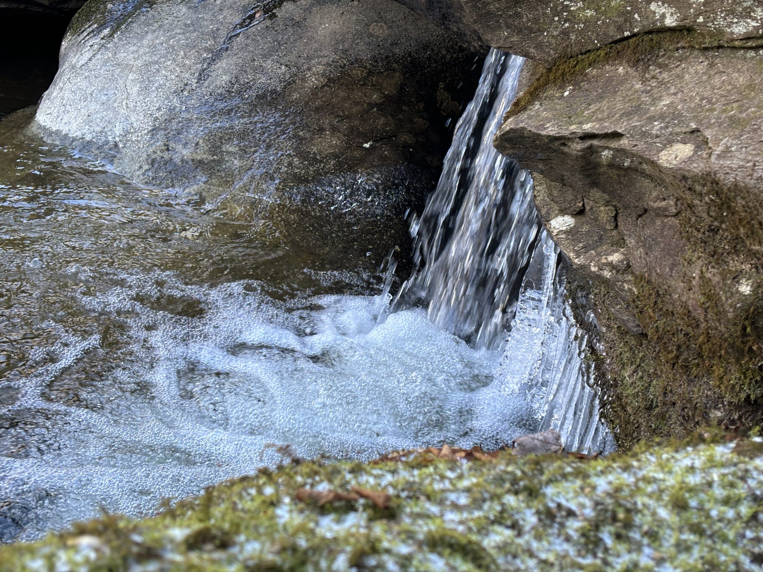
Following the Boone Fork Trail combined with the Mountain-to-Sea Trail, we came across Hebron Falls after 30ish minutes. It’s a steep trail down and a pain to come up, but it’s worth it! Per Explore Boone, the area is known as Hebron Colony Rocks from the Hebron Colony Ministries on Old Turnpike Rd. It feels as if the waterfall is more of a colony of rocks. If you’re coming from our direction, you will hear it. But, when you come down to Hebron Falls, it will appear much different from your expectations. The water rushes down these rocks one by one. The rocks, or more like boulders, make up a mountain of themselves along the falls.
I’ve never seen a waterfall feature quite like it. Which makes me glad for the journey. I will note that there was an interesting cement structure a few hundred feet off the beaten path. Not sure what it’s for, but it’s extremely weathered. It makes me wonder what life was like here and who spent their time in this place. Regardless, I wasted no time exploring and taking pictures. Ice formed in some of the pools of water along with beautiful icicles by the falls.

We continued on back up the grueling hill climb of the trail. We hiked down the Boone Fork/Mountain-to-Sea section for a little longer. I debated doing the full look as we would have 4 miles to go plus about 1.5 miles to the car. It was certainly doable but ate up all the daylight. I decided against it and am glad I did, as I’ll describe later. Regardless, we saw one interesting final sight. A small wooden ladder you use to ascend past the rocks. It was a unique piece of trail infrastructure and a good turnaround spot.
Like I’ve alluded to before, the hike back was less than easy. Much of our hiking was downhill, so we had to make that back uphill. It was the blindspot to my lack of research, but worth the challenge. From what I can tell from REI Hiking Project online, we climbed 700-800 feet up from our turnaround spot. Possibly a bit more. The hardest part was towards the end, as the ascent was steep. If you’re planning to do this exact same route, I would keep this in mind.
Overall, I would say this was an enjoyable hike. The cold got to be, but I packed well and layered well so I didn’t have trouble. The time of year also kept people off the trail, which added to the experience. I plan to hit this section and possibly the Boone Fork loop again. Preferably in the spring or fall times when we have mild weather in North Carolina.
Preparing for Your Journey
If you plan or are considering visiting this trail or Hebron Falls, then read below. I’ll provide my details from my experiences. However, I encourage you to be adventurous and make your own journey. Just make sure to be safe in the process.
Getting There
Blowing Rock is located just south of Boone, North Carolina. Boone is well known for Appalachian State University. So, many Charlotte locals like myself know it well. But if you’re not from the area, then following major roads and interstate to the Boone/Blowing Rock area is your best bet. I’ll point you to your GPS there. When coming to town, Blowing Rock is a quaint mountain town. Many small shops, restaurants, and businesses. You won’t find much as far as chains here. However, you will find heated/cooled public restrooms by the police station! Plan to spend your non-hiking time in Blowing Rock if you want to shop small. There are even two beautiful waterfalls in town off of the Glen Burney Trail.
Boone, North Carolina, is your more commercialized town. It’s about 15 minutes from Blowing Rock. Most of your chain and big box stores are located here. If you’re spending the night in the area, Boone has more accommodations and nightlife. Regardless, both towns are great “basecamps” for outdoor adventures.
The gravel lot I mentioned is located here: 36°09’34.9″N 81°43’04.5″W. Off of Shulls Mill Rd. It’s a short drive past the parkway down the windy two-lane. The gravel lot can accommodate up to 5 cars, maybe. The Mountain-to-Sea Trail intersects here and gives you the option to go either way.
Alternatively, if you’re interested in other parts of the hike like the Boone Fork Trail or Hebron Falls, you can access them at Julian Price Memorial Park. This is located off of the Blue Ridge Parkway, so be warned it can become inaccessible when the parkway closes. Julian Price Memorial Park contains Julian Price Picnic Area located here: 36°08’17.4″N 81°43’40.3″W. The Boone Fork Trail loop is accessible here. Public bathrooms are also available.
The Trail
Regardless of your hike, the trails are strenuous. I would recommend proper hiking gear and the ability to deal with rough terrain. Good stamina in the body is also recommended. If you have never hiked before, I would not recommend these trails. On the portion I hiked, the trail starts narrow, with a steep drop. Then it descends to relatively modest terrain. Once you join the Boone Fork Trail, it gets back to rough terrain. Besides the bridge, there’s not much infrastructure on the trail. The path does seem to be maintained regularly. So, downed trees and other issues should not be a worry.
In Conclusion
I’m grateful to have done this hike since the winter has been quite busy for me. There’s always a unique vibe to mountain hikes that I miss. If you go, I hope you enjoy it as well. Please feel free to share pictures or any reports from the hike. Now go enjoy the day!


Leave a Reply